Home
Wexford County Council

GaeilgeAccessibility ToolsMyOnline ServicesGaeilge 

Menu
  • Featured
  • Planning
  • Libraries
  • Council & Democracy
  • Waste & Recycling
  • Roads, Travel & Parking
  • Housing
  • Environment & Climate Change
  • Motor Tax
  • Business
  • Community and Sports
  • Arts & Culture

Breadcrumb

  1. Home
  2. Maps
  3. Wexford Geohub

Wexford Geohub

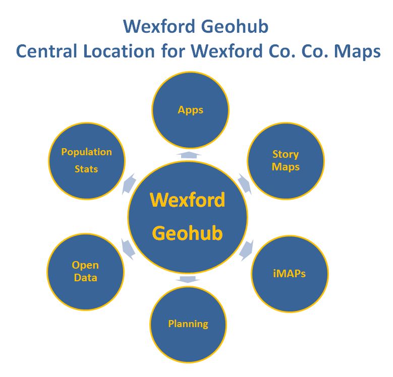
Click here to create your own Online Maps and view All Wexford County Councils Public Mapping applications.

This online platform will allow users to explore all Wexford County Councils mapping applications and you can:

  • create your own online maps
  • download datasets,
  • generate a report of all planning applications within your site/areas of interest
  • explore our gallery of story maps
  • view our new Historical Map Viewer that will allow you explore how Wexford has changed
  • examine demographics via a map. Using information extracted from the most recent population census, Wexford County Council has published useful and interesting details about County Wexford such as:
    • commuter profiles
    • travelling times
    • employee skills and knowledge


Maps
iMAPs - public mapviewer
Wexford Geohub
Maps Gallery
Maps on your mobile

WCCComhairle Contae Loch Garman
Wexford County Council

Footer Menu

Show — Footer Menu Hide — Footer Menu
  • Home
  • Contact Us
  • Your Privacy
  • Cookie Policy
  • MapAlerter Wexford
  • Twitter
  • My Online Services
  • Log In

Footer ReciteMe Link

Switch to Gaeilge Accessibility Statement